Tsunami Coastline - stock photo
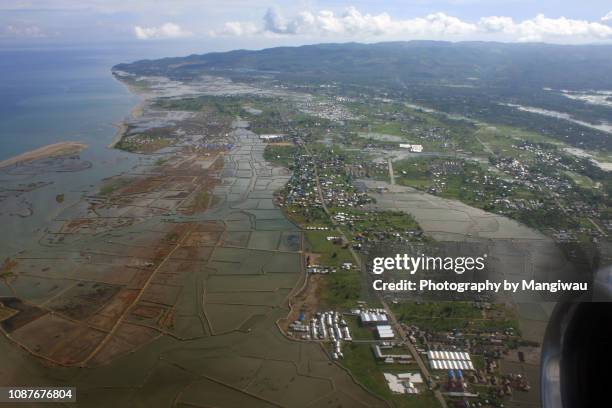
A November 2007 oblique aerial photo showing the coastal plain around Banda Aceh, almost three years after the area was devastated by the Great 2004 Indian Ocean Earthquake and Tsunami. Reconstruction has taken place in inland slightly elevated portions of the coastal plain that were stripped bare by the tsunami. Areas closer to the coast have remained unsuitable for habitation.

Get this image in a variety of framing options at Photos.com.
PURCHASE A LICENCE
All Royalty-Free licences include global use rights, comprehensive protection, and simple pricing with volume discounts available
$500.00
+GST NZD
Getty ImagesTsunami Coastline High-Res Stock Photo Download premium, authentic Tsunami Coastline stock photos from Getty Images. Explore similar high-resolution stock photos in our expansive visual catalogue.Product #:1087676804
 Download premium, authentic Tsunami Coastline stock photos from Getty Images. Explore similar high-resolution stock photos in our expansive visual catalogue.Product #:1087676804
$500+GST$50+GST
Getty Images
In stockDETAILS
Credit:
Creative #:
1087676804
Licence type:
Collection:
Moment
Max file size:
6000 x 4000 px (50.80 x 33.87 cm) - 300 dpi - 9 MB
Upload date:
Location:
Banda Aceh, Aceh, Indonesia
Release info:
No release required
Categories:
- Tsunami,
- Flood,
- Indian Ocean,
- Beach,
- Recovery,
- Aceh,
- Aerial View,
- Assistance,
- Banda Aceh,
- Barrier Island,
- Change,
- Charity and Relief Work,
- Coastal Feature,
- Coastal Plain,
- Coastal Road,
- Coastline,
- Colour Image,
- Construction Industry,
- Earthquake,
- Emergencies and Disasters,
- Endurance,
- Environment,
- Flat - Physical Description,
- Flood Plain,
- Flying,
- Geology,
- Habitat for Humanity,
- Horizontal,
- Indonesia,
- Landscape - Scenery,
- Nature,
- New Life,
- No People,
- Paddy Field,
- Photography,
- Physical Geography,
- Population Explosion,
- Rebuilding,
- Reclaimed Land,
- Sea,
- Sumatra Island,
- Tectonic,
- Travel,
- Water,
- Wave - Water,